PARK AT A GLANCE
Size: 220km² with an altitude of 670-760m above sea level
Semliki Forest Reserve was created in 1932 and upgraded to national park status in 1993.
It is the only tract of true lowland tropical forest in East Africa, hosting 441 recorded bird species and 53 mammals.
Large areas of this low-lying park may flood during the wet season,a brief reminder of the time when the entire valley lay at the bottom of a lake for seven million years.
Four distinct ethnic groups live near the park – Bwamba farmers live along the base of the Rwenzori while the Bakonjo cultivate the mountain slopes. Batuku cattle keepers inhabit on the open plains and Batwa pygmies, traditionally hunter gathers, live on the edge of the forest.
Semliki National Park sprawls across the floor of the Semliki Valley on the remote, western side of the Rwenzori. The park is dominated by the easternmost extension of the great Ituri Forest of the Congo Basin. This is one of Africa’s most ancient and bio-diverse forests; one of the few to survive the last ice age, 12-18,000 years ago.
The Semliki Valley contains numerous features associated with central rather than eastern Africa. Thatched huts are shaded by West African oil palms; the Semliki River (which forms the international boundary) is a miniature version of the Congo River, the forest is home to numerous Central African wildlife species, and the local population includes a Batwa pygmy community that originated from the Ituri. As a result, this park provides a taste of Central Africa without having to leave Uganda.
While Semliki’s species have been accumulating for over 25,000 years, the park contains evidence of even older processes. Hot springs bubble up from the depths to demonstrate the powerful subterranean forces that have been shaping the rift valley during the last 14 million years.
size: 795km2
Kibale is highest at the park’s northern tip, which stands 1,590m above sea level. The lowest point is 1,100m on the floor of the Albertine Rift Valley to the south.
over 351 tree species have been recorded in the park, some rise to over 55m and are over 200 years old.
Kibale’s varied altitude supports different types of habitat, ranging from wet tropical forest on the Fort Portal plateau to woodland and savanna on the rift valley floor.
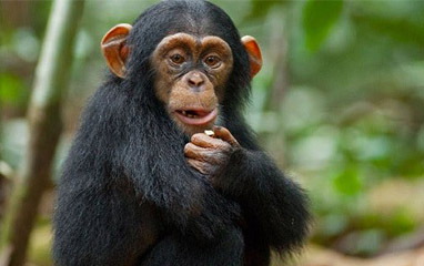
Kibale is one of Africa’s foremost research sites. While many researchers focus on the chimpanzees and other primates found in the park, others are investigating Kibale’s ecosystems, wild pigs and fish species, among other topics.
Kibale National Park contains one of the loveliest and most varied tracts of tropical forest in Uganda. Forest cover, interspersed with patches of grassland and swamp, dominates the northern and central parts of the park on an elevated plateau.Kibale is famously known for Chimpanzee tracking
The park is home to a total of 70 mammal species, most famously 13 species of primate including the chimpanzee.
It also contains over 375 species of birds. Kibale adjoins Queen Elizabeth National Park to the south to create a 180km-long corridor for wildlife between Ishasha, the remote southern sector of Queen Elizabeth National Park, and Sebitoli in the north of Kibale National Park.The Kibale-Fort Portal area is one of Uganda’s most rewarding destinations to explore. The park lies close to the tranquil Ndali-Kasenda crater area and within half a day’s drive of the Queen Elizabeth, Rwenzori Mountains and Semuliki National Parks, as well as the Toro-Semliki Wildlife Reserve
PARK AT A GLANCE
Size: 33.7km2, making it Uganda’s smallest National Park.
The park takes its name from “Gahinga” – the local word for the piles of volcanic stones cleared from farmland at the foot of the volcanoes.
The British administration declared the area a game sanctuary in 1930; it was gazetted as a National Park in 1991.
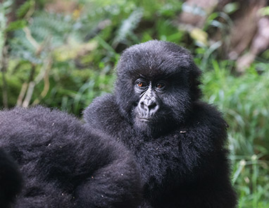
Mgahinga has one habituated trans-boundary gorilla group.
The Batwa were self-sufficient – and visitors can see how during a fascinating tour with a Batwa guide to learn the secrets of the forest.
Mgahinga Gorilla National Park sits high in the clouds, at an altitude of between 2,227m and 4,127m. As its name suggests, it was created to protect the rare mountain gorillas that inhabit its dense forests, and it is also an important habitat for the endangered golden monkey.
As well as being important for wildlife, the park also has a huge cultural significance, in particular for the indigenous Batwa pygmies. This tribe of hunter-gatherers was the forest’s “first people”, and their ancient knowledge of its secrets remains unrivalled.
Mgahinga’s most striking features are its three conical, extinct volcanoes, part of the spectacular Virunga Range that lies along the border region of Uganda, Congo and Rwanda. Mgahinga forms part of the much larger Virunga Conservation Area which includes adjacent parks in these countries. The volcanoes’ slopes contain various ecosystems and are biologically diverse, and their peaks provide a striking backdrop to this gorgeous scenery.
Size: 220km² with an altitude of 670-760m above sea level
Semuliki Forest Reserve was created in 1932 and upgraded to national park status in 1993. It is the only tract of true lowland tropical forest in East Africa, hosting 441 recorded bird species and 53 mammals.
Large areas of this low-lying park may flood during the wet season,a brief reminder of the time when the entire valley lay at the bottom of a lake for seven million years.
Four distinct ethnic groups live near the park – Bwamba farmers live along the base of the Rwenzori while the Bakonjo cultivate the mountain slopes. Batuku cattle keepers inhabit on the open plains and Batwa pygmies, traditionally hunter gathers, live on the edge of the forest.
Semuliki National Park sprawls across the floor of the Semliki Valley on the remote, western side of the Rwenzori. The park is dominated by the easternmost extension of the great Ituri Forest of the Congo Basin. This is one of Africa’s most ancient and bio-diverse forests; one of the few to survive the last ice age, 12-18,000 years ago.
The Semliki Valley contains numerous features associated with central rather than eastern Africa. Thatched huts are shaded by West African oil palms; the Semliki River (which forms the international boundary) is a miniature version of the Congo River, the forest is home to numerous Central African wildlife species, and the local population includes a Batwa pygmy community that originated from the Ituri. As a result, this park provides a taste of Central Africa without having to leave Uganda.
While Semuliki’s species have been accumulating for over 25,000 years, the park contains evidence of even older processes. Hot springs bubble up from the depths to demonstrate the powerful subterranean forces that have been shaping the rift valley during the last 14 million years.
do not miss the natives of the park, the birds, tree species and the hot springs.
web: www.trotsandsfari.com
email:info@trotsandsafari.com
PARK AT A GLANCE
Size: 370km2
Altitude: 1,220m – 1,828m above sea level.
Lake Mburo National Park is a compact gem, located conveniently close to the highway that connects Kampala to the parks of western Uganda. It is the smallest of Uganda’s savannah national parks and underlain by ancient Precambrian metamorphic rocks which date back more than 500 million years. It is home to 350 bird species as well as zebra, impala, eland, buffalo, oribi, Defassa waterbuck, leopard, hippo, hyena, topi and reedbuck.
Together with 13 other lakes in the area, Lake Mburo forms part of a 50km-long wetland system linked by a swamp. Five of these lakes lie within the park’s borders. Once covered by open savanna, Lake Mburo National Park now contains much woodland as there are no elephants to tame the vegetation. In the western part of the park, the savanna is interspersed with rocky ridges and forested gorges while patches of papyrus swamp and narrow bands of lush riparian woodland line many lakes. Let us take you on this journey of adventure.
web: www.trotsandsafari.com
Email:info@trotsandsafari.com
PARK AT A GLANCE
Size: 3,840km2
Murchison Falls became one of Uganda’s first national parks in 1952
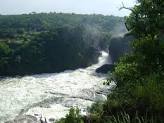
At Murchison Falls, the Nile squeezes through an 8m wide gorge and plunges with a thunderous roar into the “Devil’s Cauldron”, creating a trademark rainbow
The northern section of the park contains savanna and borassus palms, acacia trees and riverine woodland. The south is dominated by woodland and forest patches
The 1951 film “The African Queen” starring Humphrey Bogart was filmed on Lake Albert and the Nile in Murchison Falls National Park
Murchison Falls National Park lies at the northern end of the Albertine Rift Valley, where the sweeping Bunyoro escarpment tumbles into vast, palm-dotted savanna. First gazetted as a game reserve in 1926, it is Uganda’s largest and oldest conservation area, hosting 76 species of mammals and 451 birds.
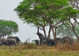
The park is bisected by the Victoria Nile, which plunges 45m over the remnant rift valley wall, creating the dramatic Murchison Falls, the centerpiece of the park and the final event in an 80km stretch of rapids. The mighty cascade drains the last of the river’s energy, transforming it into a broad, placid stream that flows quietly across the rift valley floor into Lake Albert. This stretch of river provides one of Uganda’s most remarkable wildlife spectacles. Regular visitors to the riverbanks include elephants, giraffes and buffaloes; while hippos, Nile crocodiles and aquatic birds are permanent residents.
Notable visitors to the park include Winston Churchill, Theodore Roosevelt, Ernest Hemingway and several British royals.
discover the beauty of Murchison falls national park with trots and safaris
web: www.trotsandsafari.com
email: info@trotsandsafari.com
PARK AT A GLANCE
Size: 1,978km².
Queen Elizabeth spans the equator line; monuments on either side of the road mark the exact spot where it crosses latitude 00. The park was founded in 1952 as Kazinga National Park, and renamed two years later to commemorate a visit by Queen Elizabeth II. The park is home to over 95 mammal species and over 600 bird species.
The Katwe explosion craters mark the park’s highest point at 1,350m above sea level, while the lowest point is at 910m, at Lake Edward.
Queen Elizabeth National Park is understandably Uganda’s most popular tourist destination. The park’s diverse ecosystems, which include sprawling savanna, shady, humid forests, sparkling lakes and fertile wetlands, make it the ideal habitat for classic big game, ten primate species including chimpanzees and over 600 species of birds.
Set against the backdrop of the jagged Rwenzori Mountains, the park’s magnificent vistas include dozens of enormous craters carved dramatically into rolling green hills, panoramic views of the Kazinga Channel with its banks lined with hippos, buffalo and elephants, and the endless Ishasha plains, whose fig trees hide lions ready to pounce on herds of unsuspecting Uganda kob.
As well as its outstanding wildlife attractions, Queen Elizabeth National Park has a fascinating cultural history. There are many opportunities for visitors to meet the local communities and enjoy storytelling, dance, music and more. The gazetting of the park has ensured the conservation of its ecosystems, which in turn benefits the surrounding communities.
Discover queen elizabeth wonders with trotsandsafaris.
Web: www.trotsandsafari.com
Email: info@trotsandsafari.com

